Black Swift Technologies SØ™ UAS Platform
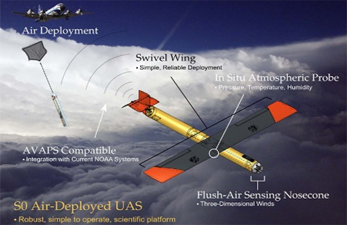
The Black Swift SØ™ UAS is an intelligent unmanned aircraft capable of autonomous flights at altitudes of up to 15,000 feet above ground-level.
Black Swift Technologies SØ™ UAS Platform Read More »
Articles related to uncrewed systems (air and sea).
The Black Swift SØ™ UAS is an intelligent unmanned aircraft capable of autonomous flights at altitudes of up to 15,000 feet above ground-level.
Black Swift Technologies SØ™ UAS Platform Read More »
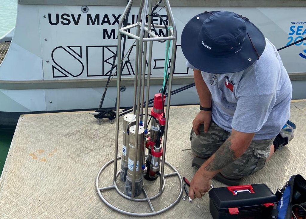
As part of the ongoing Tonga Eruption Seabed Mapping Project a team of scientists conducted a deep-water survey to better understand impacts of the January 2022 Hunga Tonga-Hunga Ha’apai volcanic eruption on the ocean environment.
NOAA technology used to research deep-sea volcanic and hydrothermal activity Read More »
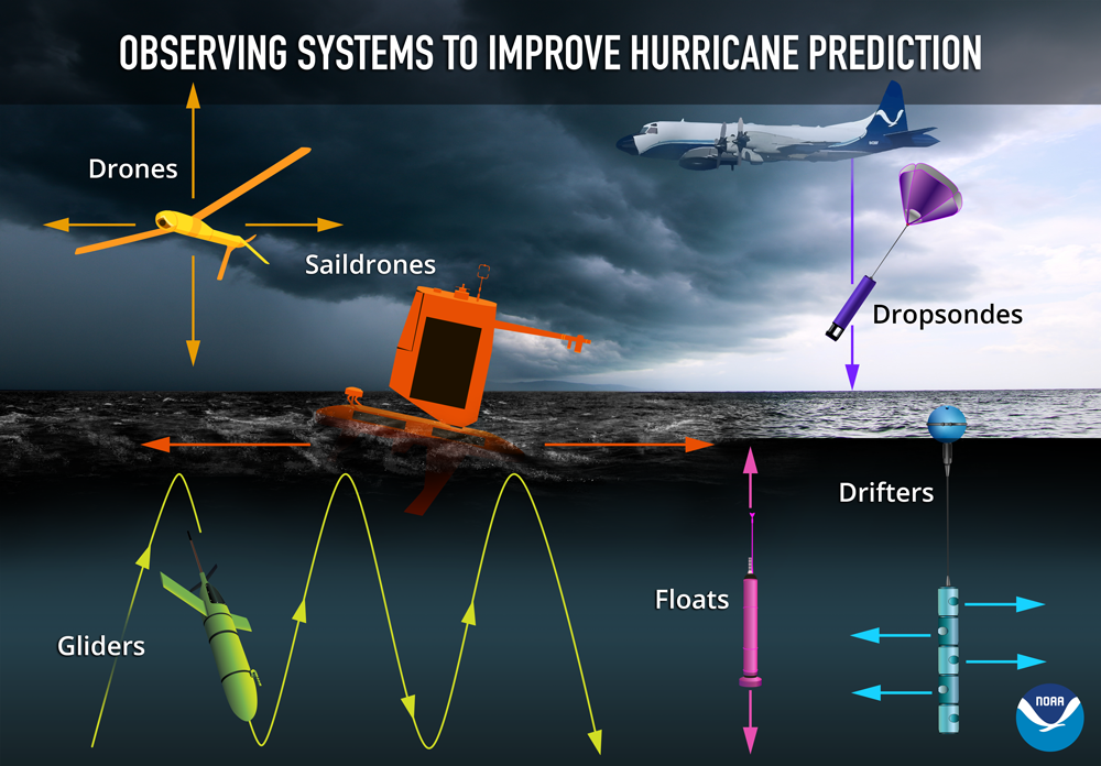
In partnership with NOAA, Saildrone Inc. is deploying seven ocean drones to collect data from hurricanes during the 2022 hurricane season with the goal of improving hurricane forecasting. For the first year, two saildrones will track hurricanes in the Gulf of Mexico.
NOAA uses array of marine and air uncrewed tools to improve hurricane forecast models Read More »
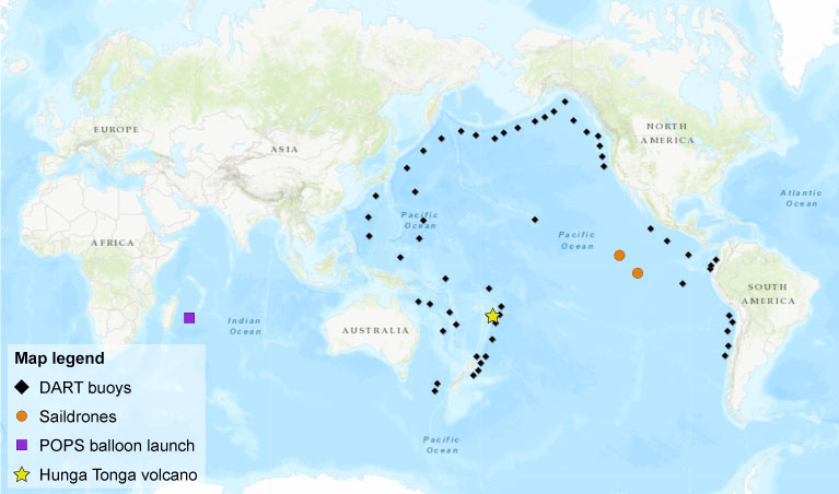
When a volcano in the South Pacific Ocean erupted in January 2022, NOAA researchers were well-equipped to study the multi-hazard event by sky and by sea. Key technologies and strategic partnerships made it possible for NOAA to issue warnings that saved lives around the world, while also collecting scientific data that will improve forecasting models and disaster response for future events.
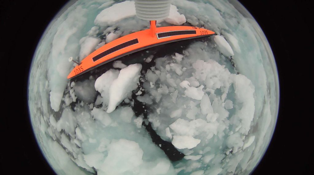
NOAA PMEL researchers sent ocean drones to the U.S. Arctic to test their remote navigation capabilities close to ice and to collect data on Arctic weather, climate, and ecosystems. The saildrones were equipped to observe oceanic and atmospheric variables that are needed to estimate air-sea fluxes of heat, momentum, and carbon dioxide. Comparing Saildrone data to data obtained through existing collection methods allowed researchers to identify ways to improve ice navigation in the future.
Exploring the Pacific Arctic Seasonal Ice Zone With Saildrone USVs Read More »