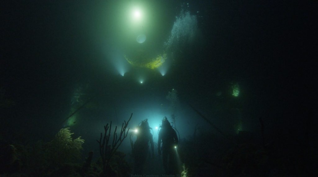
Partnerships

Parent category.  May or may not be used as a tag in the future.

Public-private research partnerships are fueling NOAA innovation

A record number of NOAA Cooperative Research and Development Agreements in 2021 has generated scientific and economic benefits Research partnerships are increasingly important as scientists work to address complex global problems like coastal resilience, food security, and climate change.

Public-private research partnerships are fueling NOAA innovation Read More »

A saildrone surrounded by sea ice

Exploring the Pacific Arctic Seasonal Ice Zone With Saildrone USVs

NOAA PMEL researchers sent ocean drones to the U.S. Arctic to test their remote navigation capabilities close to ice and to collect data on Arctic weather, climate, and ecosystems. The saildrones were equipped to observe oceanic and atmospheric variables that are needed to estimate air-sea fluxes of heat, momentum, and carbon dioxide. Comparing Saildrone data to data obtained through existing collection methods allowed researchers to identify ways to improve ice navigation in the future.

Exploring the Pacific Arctic Seasonal Ice Zone With Saildrone USVs Read More »

Saildrone Uncrewed Ocean Exploration Vehicle on the water

These 5 technologies are helping save our ocean

Protecting and exploring our global ocean is a huge job: It covers more than 70 percent of Earth’s surface. Cutting-edge technologies help us dive deeper, gather more ocean data and solve some of its biggest challenges.

Here are 5 innovative high-tech tools borne from NOAA’s partnerships with the fishing industry and technology companies large and small.

These 5 technologies are helping save our ocean Read More »

Mayday.ai graphical threat detection matrix.

New technology uses NOAA data to provide faster disaster warnings

Mayday.ai applies artificial intelligence to NOAA satellite imagery to detect natural disasters, starting with wildfires Story originally published on Environmental News Network In 2017, as Kian Mirshahi watched wildfires rage across his home state of California, he wondered if there might be a way to get real-time information to first responders and citizens to help coordinate actions on the ground. More specifically, he wondered if Artificial Intelligence, or AI, might provide a key to faster decision-making. Fortunately, NOAA had recently rolled out two major developments, which provided the fuel for Mirshahi’s innovative drive. In 2016 and 2018, NOAA launched two new powerful geostationary satellites, GOES 16 and 17, which for the first time provided high-definition color imagery of the entire United States. At the same time, NOAA also kicked off a series of innovative Cooperative Research and Development Agreements with the major Cloud Service providers in the United States to provide easy access to NOAA data, especially GOES data. These agreements have since transitioned to an operational activity known as the NOAA Big Data Program (BDP). The BDP provided the general public the ability to access and analyze near real-time data feeds from GOES and other sources, without the need for a satellite dish and a supercomputer. This low-cost access to near real-time data, together with the powerful computing resources and advanced AI technology available on the Cloud Service Providers’ platforms, has opened the doors for small startups and innovators to make big impacts in NOAA’s mission areas. Mirshahi and his company, Mayday ai, are one of the early adopters in this new big data world. From Idea to Action Mirshahi founded his company, Mayday.ai, in May 2018 with the mission to help save lives, reduce costs and impacts of disasters, and protect the environment. Using multiple resources, including satellites, traffic cameras and social media, the company has developed a cloud-based platform which can provide centralized early warning and dispatch for first responders and emergency managers combating high-impact events, such as wildfires. “We believe our platform can improve the flow of critical information between first responders and to the public, which traditionally has been impeded due to the fragmented nature of the disaster management communications,” Mirshahi said. “At the same time, we believe our platform can directly involve people at the community level in order to build disaster resiliency.” Little did Mirshahi know, 2020 would prove to be a true trial-by-fire year for his new company. Into the Fire: 2020 Proof of Concept The 2020 fire season has been unprecedented in California, Oregon, and beyond, which has put Mirshahi’s concept quickly to the test and has provided multiple opportunities to evaluate and fine tune his early-warning technology. Mayday.ai has been training its analysis engine using Machine Learning to see through partial clouds, which has enabled Mayday.ai to detect a high proportion of wildfire events up to 15 minutes after starting and well in advance of 911 calls reporting the incidents. Mayday.ai has also enhanced its partial cloud detection technology to include lighting mapping every 10 minutes. This additional capability allowed Mayday.ai to quickly identify lightning-caused fires. This is particularly powerful in a year where records are being broken with dry lightning causing wildfires in areas with ongoing drought conditions. “Today we are seeing wildfire events as early as four hours ahead of 911 calls, from 22,000 miles above sea level,” said Mirshahi. Ultimately, we hope to work with all stakeholders locally, nationally, and globally to prevent these events from causing so much damage to lives and livelihoods.” Supporting Innovation The NOAA Big Data Program is just one part of NOAA’s newly-developed Cloud and Data strategies. With the volume and velocity of NOAA’s data expected to increase exponentially with the advent of new observing systems and increasing data-collection capabilities, these strategies will allow the agency to support this growth. “Had NOAA not given us a chance to get access to real time data for our initial hypothesis testing, we simply wouldn’t have been able to start this project” said Mirshahi. “As we build a platform for community-level disaster management, NOAA and its big data efforts continue to be integral to our business.” The NOAA Technology Partnerships Office is a key link for increasing the impact of the public’s investments in NOAA’s science and engineering. Through a portfolio of Cooperative Research and Development Agreements, which enable NOAA scientists and engineers to work closely with their counterparts in the private sector, and seed funds provided to small businesses through the Small Business Innovation Research Program (SBIR), NOAA is supporting innovation, the U.S. economy, and our critical mission goals. “Aligning NOAA’s capabilities with the constantly evolving needs of our stakeholders requires both collaboration and partnerships to deliver data and services in a way that stakeholders expect to consume them,” said Neil Jacobs, Ph.D., acting NOAA administrator. “Creative partnerships with commercial cloud providers set NOAA apart from others in making more of its data publicly accessible.” NOAA’s vast data sets are a fantastic resource, but without interpretation and application to the needs of the public, they are just large sets of numbers. While NOAA provides a wide range of products and services to the public using these data, the agency will continue to seek out innovators like Mirshahi and Mayday.ai to add even more value and to help us achieve our mission. Note: Any reference obtained from this website to a specific company, product, process, or service does not constitute or imply an endorsement by NOAA. Published on October 16, 2020 Media contact: suzi.webster@noaa.gov

New technology uses NOAA data to provide faster disaster warnings Read More »