
GIS for the Ocean
Create a prototype for a one-of-a-kind, fully interoperable open data platform to provide equitable, actionable, and ready-to-use ocean and coastal data for decision makers and communities.
Create a prototype for a one-of-a-kind, fully interoperable open data platform to provide equitable, actionable, and ready-to-use ocean and coastal data for decision makers and communities.

Measure greenhouse gases and other pollutants during domestic U.S. flights onboard a United Airlines aircraft. Establish a partnership that could significantly improve monitoring of carbon dioxide, methane, and other greenhouse gases, as well as improving the accuracy of weather forecasts in the United States. In addition to the NOAA press release linked above, see the White House Fact Sheet press release for more information.
Supporting Atmospheric Research & Expanding Observations from Platforms Opportunity Read More »
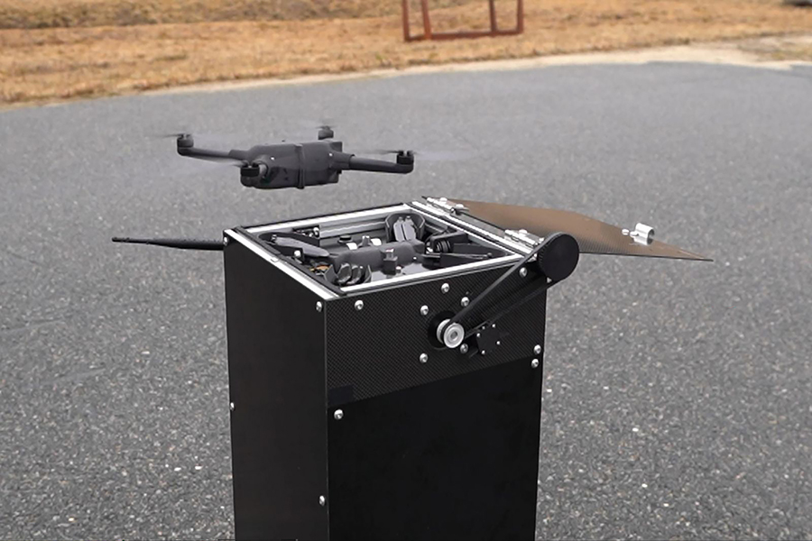
Deploy, test, and evaluate observations gathered using WeatherHive nano-sized uncrewed aircraft systems for weather forecasting and its potential benefits during severe weather events.
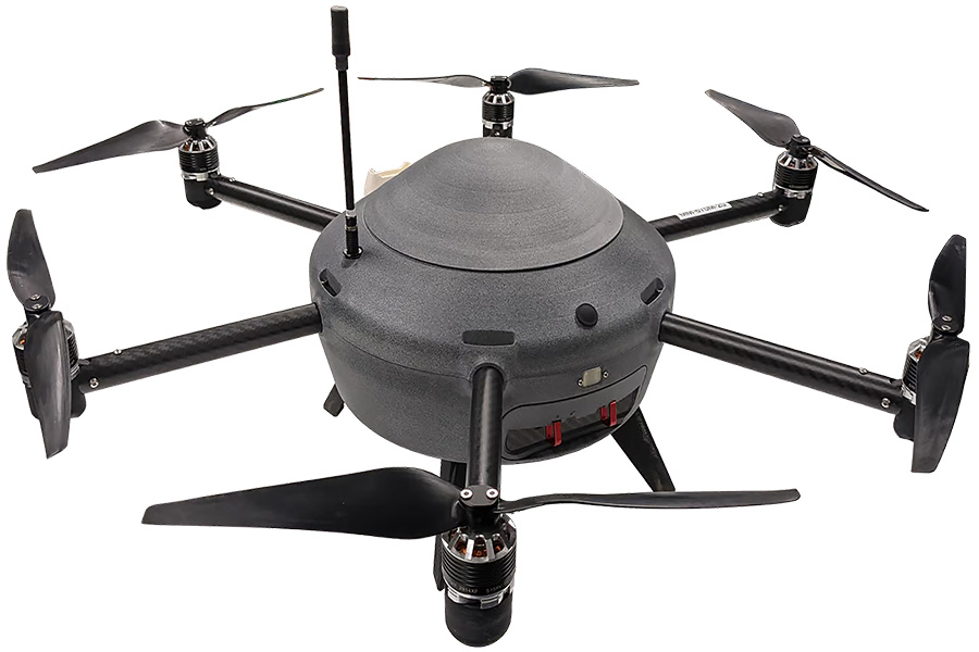
Deploy advanced weather drones to gather upper air observations up to an altitude of 16,900 feet. NOAA will evaluate and determine if the data collected could benefit forecasters at the National Weather Service as well as the effectiveness of deploying drones in the weather observation role.
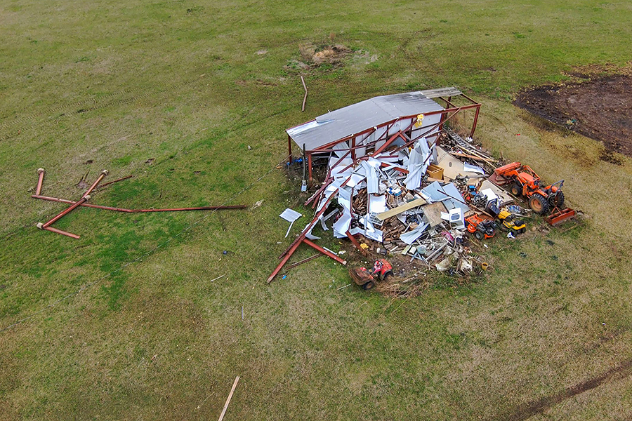
Conduct collaborative research and development on the exploration of rapid and efficient uncrewed aircraft systems deployment strategies for collecting and distributing aerial imagery of damage resulting from severe storms that could better enable National Weather Service offices in their duties to conduct post-storm damage assessments.
Rapid Deployment of UAS for Storm Damage Imagery Collection Read More »