The NOAA Small Business Innovation Research (SBIR) Program awards funding to U.S. small businesses to support the development of innovative technologies that are relevant to NOAA’s mission, and to encourage their commercial adoption.
Featured below are NOAA SBIR-funded technologies that are commercially available. Company contact information is included on each page if you wish to purchase the technology.
In addition to the following NOAA-funded technologies, you can find thousands of available technologies on the Small Business Administration’s central SBIR Program website. Use the SBIR keyword search engine to discover technologies that can meet your needs!
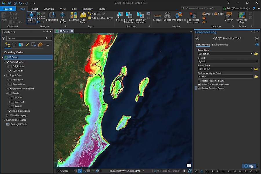
TCarta’s Trident Tools SDB Toolbox provides a user-friendly suite of tools for the production of satellite-derived bathymetry and imagery-derived bathymetry within the Esri ArcGIS Pro environment.
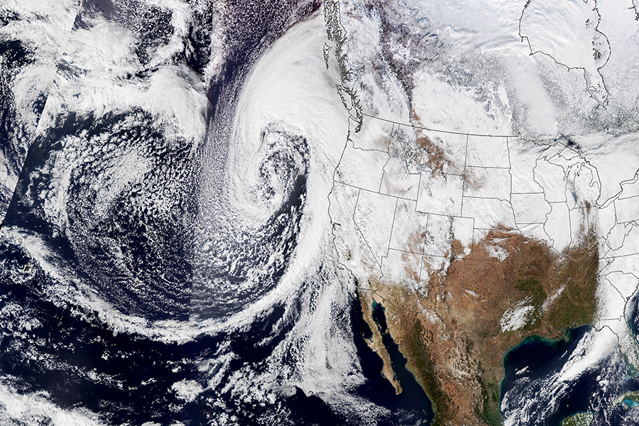
Learn2, INNOVIM‘s groundbreaking Landfalling Event Atmospheric River Neural Network, is an AI-driven software platform that reduces weather forecast uncertainty within a 10-day window, providing accurate and timely predictions for extreme precipitation events.
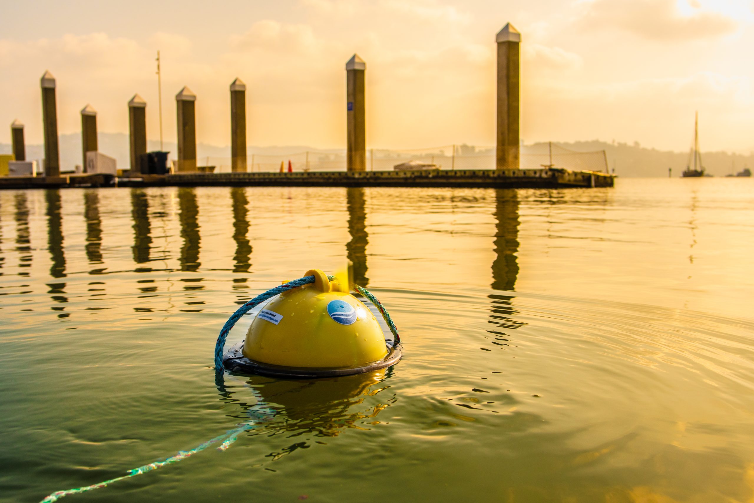
The Blue Ocean Gear Farallon Smart Buoy System allows commercial fishing fleets to monitor the location and movement of their deployed fishing gear — anytime, anywhere.
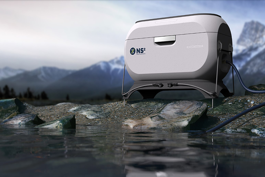
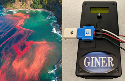
The Harmful Algal Bloom Detection Instrument is a low-cost, portable instrument that has been developed for detecting toxins found in seawater during harmful algal blooms.
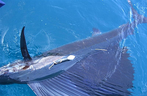
SeaTag™ is a solar-powered marine technology that offers low-cost, reusable, and modular tags for tracking sea mammals in both salt and freshwater environments.
GeoCollaborate is a software application that permits users to access and view trusted online data and to collaborate in real-time in order to improve situational awareness and decision-making.
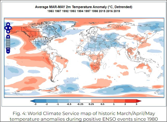
The World Climate Service provides meteorologists and other climate-sensitive professionals with critical long-range forecast information to support climate risk-related decision making.
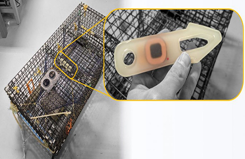
The Wireless Open Water Logger enables large-scale, opportunistic ocean sampling by providing a low-cost, reliable, and open-source ocean temperature and depth logger.